Publications
IAHS publishes Hydrological Sciences Journal and three book series:
- the Benchmark Papers in Hydrology series that collects together, by theme, the seminal scientific papers that provided the foundation for modern hydrology.
- the "Red Books" or Proceedings and Reports series and from volume 369 (2016) the new online open-access proceedings journal, Proceedings of the International Association of Hydrological Sciences, PIAHS.
- the "Blue Books" or Special Publications series.
Details of all books are provided below. Papers in Red Books (except 24, 25 and 26) are available to view/download for free as pdfs. To directly access the different series, for example Blue Books, use the 'Category' option in the Search area. To search for specific books by title, ISBN, Editor or publication number use the facility below. To search for specific papers/authors use Paper Search. Books can be purchased online by clicking on the shopping basket to purchase. Members receive discounts. The Catalogue and June 2015 Update can be viewed/downloaded.
HSJ Digest
The HSJ Digest is our bi-monthly synopsis of the latest news from Hydrological Sciences Journal. Find links to all the articles published in the latest issues of the Journal, together with the Editors’ choice of featured articles and various other news and noteworthy items.

Enquiries: [email protected]
tel: +44 1491 692515
IAHS, UKCEH Wallingford, Oxfordshire, OX10 8BB, UK
Benchmark
Palaeohydrology Author / Editor: Victor R. Baker Price: £75.00 Palaeohydrology - Victor R. Baker Palaeohydrology originated with and continues to have a strong focus on palaeofluvial processes, especially palaeoflooding, and this is reflected in eight sections:
An excellent resource for graduate and post-graduate level courses in hydrology and hydro-geomorphology, reproducing many important papers that are otherwise difficult to access. Victor R. Baker is Regents Professor in Hydrology and Water Resources at the University of Arizona, USA, and holds joint chairs in the departments of Geosciences and Planetary Sciences there. His research interests broadly concern palaeohydrology and related aspects of geomorphology, with a particular focus on flood processes. He also works in the area of planetary geomorphology and on issues that involve Earth science in relation to public policy, the environment and philosophy of science. IAHS arranged for copyright permission to reproduce the papers included in this volume as print copy. We are unable to provide digital versions. Contents for Palaeohydrology
| Isotope Hydrology Author / Editor: P. K. Aggarwal, K. O. Fröhlich, J. R. Gat & R. Gonfiantini Price: £70.00 Isotope Hydrology - P. K. Aggarwal, K. O. Fröhlich, J. R. Gat & R. Gonfiantini Isotope Hydrology uses stable and radioactive isotopes of water and its dissolved constituents to trace hydrological processes, including the pathways of rainfall and snowmelt to, and interactions between, aquifers, lakes and rivers. The potential of using stable isotopes of water was recognized in the 1930s, but not fully explored until the 1950s, since when the scope and nature of isotope applications in hydrology have blossomed. Improvements in measure¬ment techniques have facilitated use of isotopes in many contexts, and isotope hydrology has become mainstream, as documented in this volume of reprinted papers and accompanying commentaries. Section A. Fundamentals includes the first papers on deuterium, 18O and tritium contents in natural waters (Friedman, 1953; Epstein & Mayeda, 1953; Libby, 1953), and Craigâas (1961) seminal paper which defined the global meteoric water line used to understand the source of natural waters. The papers that shaped our understanding of isotopes in precipitation and global circulation, e.g. Dansgaard (1964) and Craig & Gordon (1965), come in B. Atmospheric Water Cycle. The early interpretation of isotope sequences in rock and ice, including the iconic Greenland ice sheet core (Dansgaard et al., 1969), are included in C. Palaeoclimates. D. River and Lake Hydrology contains influential papers on the use of isotopes to determine the origin of stream and lake waters. E. Groundwater deals with the origin of groundwaters, the earliest use of tritium, 14C, 81Kr and 36Cl to date them, and isotope applications in pollution and groundwater remediation. An excellent resource for graduate and post-graduate level courses in hydrology, reproducing many important papers which are otherwise difficult to access. IAHS arranged for copyright permission to reproduce the papers included in this volume as print copy. We are unable to provide digital versions. Contents for Isotope Hydrology
| ||||||||||||
Forest Hydrology Author / Editor: David R. DeWalle Price: £65.00 Forest Hydrology - David R. DeWalle Forest Hydrology emphasizes the influence of forests and their management on the regime, quantity and quality of water. The volume provides an overview of the development of the discipline, with the early review by Zon (1927) and seminal contributions such as the Wagon Wheel Gap paired catchment study (Bates & Henry, 1928), and Kittredge (1948) on interception and stem flow, among the 29 Benchmark papers. IAHS arranged for copyright permission to reproduce the papers included in this volume as print copy. We are unable to provide digital versions. Contents for Forest Hydrology
| Hydro-Geomorphology, Erosion and Sedimentation Author / Editor: Michael J. Kirkby Price: £70.00 Hydro-Geomorphology, Erosion and Sedimentation - Michael J. Kirkby In the short term, hydrology responds to the topography, soils and vegetation of the landscape, but over longer time spans the entire landscape is moulded by the flow of water. The process scale ranges from the splash erosion by individual raindrops to the accumulation of sediment as alluvial fans, to the evolution of drainage networks. Kirkby presents a systematic analysis of the relationships between hydrology and geomorphology with commentaries on the papers which have been most influential in the development of research at the hydrology/geomorphology interface. Thirty-seven papers are reprinted in full or in part, the majority published pre-1970, including early contributions by Fisher (1866), Davison (1889) and Gilbert (1909), and seminal papers by Hack, Strahler, Wolman & Miller, and Melton, among others. An excellent resource for graduate and post-graduate level courses in geomorphology and hydrology, reproducing many important papers which are otherwise difficult to access. IAHS arranged for copyright permission to reproduce the papers included in this volume as print copy. We are unable to provide digital versions. Contents for Hydro-Geomorphology, Erosion and Sedimentation
| ||||||||||||
Riparian Zone Hydrology and Biogeochemistry Author / Editor: T. P. Burt, G. Pinay and S. Sabater Price: £65.00 Riparian Zone Hydrology and Biogeochemistry - T. P. Burt, G. Pinay and S. Sabater Study specifically of riparian zones is relatively new in hydrology, and while the oldest benchmark paper selected for this volume dates to 1936, several of the others were published in the 1970s and 1980s. Burt, Pinay and Sabater introduce them with a review of the role of the riparian zone. Its services as a buffer for nitrates and other agricultural and industrial pollutants has focused the attention of ecologists and hydrologists. It is an ecological boundary between terrestrial and aquatic environments, but also a distinct ecotone because of the intimate connection between the two. The 36 benchmark papers are grouped under the topics Landscape Ecology, Hydrology of the Riparian Zone, Linking Riparian Zone Hydrology to Solute Transport, Biogeochemical Processes and Methods, Riparian Buffering of Surface and Subsurface Flows, and In-stream Processes. Together, the reprinted papers and the commentaries by the editors chart the breakthroughs in the development of this important. IAHS arranged for copyright permission to reproduce the papers included in this volume as print copy. We are unable to provide digital versions. Contents for Riparian Zone Hydrology and Biogeochemistry
| Rainfall-Runoff Modelling Author / Editor: Keith Loague Price: £65.00 Rainfall-Runoff Modelling - Keith Loague This volume reprints 30 papers that exemplify the best in rainfall-runoff modelling. It charts developments from Mulvany's (1851) rational method for estimating peak flow, probably the first rainfall-runoff model, up to 1989. Benchmark papers on other empirical approaches, such as Sherman (1932) and Mockus (1949), are reprinted, as are Richards (1931) and Smith & Parlange (1978), the innovative contributions of Alan Freeze, and later Keith Beven, and the seminal papers of Moore & Clarke (1981) and Abbott et al. (1986). IAHS arranged for copyright permission to reproduce the papers included in this volume as print copy. We are unable to provide digital versions. Contents for Rainfall-Runoff Modelling
| ||||||||||||
Groundwater Author / Editor: Mary P. Anderson Price: £55.00 Groundwater - Mary P. Anderson Mary Anderson's selection and the commentaries that she has prepared to accompany the 35 reprinted papers, detail the development of groundwater hydrology during the 20th century. The fundamentals are introduced with a translation of Darcy's (1856) experimental results that led to Darcy's law, as well as classic papers by Meinzer, Theis and Hubbert, among others. The development of pumping test theory and practice, approaches to estimating aquifer parameters in the field, and flow system analysis are dealt with. Papers reflecting early concerns regarding quantification of uncertainty, how recognition of groundwater interaction with surface water grew, and early research on contaminant occurrence and transport, are included. Slichter's (1905) seminal contribution that identified dispersion in the field, and Skibitzke & Robinson's (1963) laboratory findings, are linked with more recent attempts to represent dispersion and heterogeneity with models. IAHS arranged for copyright permission to reproduce the papers included in this volume as print copy. We are unable to provide digital versions. Contents for Groundwater
| Evaporation Author / Editor: John H. C. Gash & W. James Shuttleworth Price: £40.00 Evaporation - John H. C. Gash & W. James Shuttleworth The development of evaporation measurement techniques are documented first, commencing with the Wagon Wheel Gap catchment water balance (1921), through mass budget to water transfer methods, and use of scintillometry. Dalton's seminal essay On Evaporation (1802) starts the selection of papers on evaporation estimation, which then covers atmospheric controls on the evaporation process (the original Penman and Thornthwaite papers are reproduced), vegetation controls via transpiration and interception, and finally evaporation as a component of the global climate system. The Commentaries explain the context and significance of each paper. IAHS arranged for copyright permission to reproduce the papers included in this volume as print copy. We are unable to provide digital versions. Contents for Evaporation
| ||||||||||||
Streamflow Generation Processes Author / Editor: Keith J. Beven Price: £40.00 Streamflow Generation Processes - Keith J. Beven Keith Beven's selection of 31 papers on the theme of Streamflow Generation Processes span the period from 1933 to 1984, commencing with Hortons' early papers on infiltration and on maximum groundwater levels. With the aid of the Introduction and Commentaries, they provide a stimulating insight to developments in this part of the field of hydrology. IAHS arranged for copyright permission to reproduce the papers included in this volume as print copy. We are unable to provide digital versions. Contents for Streamflow Generation Processes
|
Red Books
Circular Economy and Technological Innovations for Resilient Water and Sanitation Systems in Africa IIAuthor / Editor: Audace Amen V. Dossou-Olory, Aymar Bossa, Ernest Amoussou, Moctar Dembélé, and Gil Mahé 2nd Edition of the C2EA Water and Sanitation Week on “From Research to Innovation and Technology Transfer”, Cotonou, Benin, 3–5 June 2025 Eds. Audace Amen V. Dossou-Olory, Aymar Bossa, Ernest Amoussou, Moctar Dembélé, and Gil Mahé This volume publishes articles from the 2nd Edition of the C2EA Water and Sanitation Week on “From Research to Innovation and Technology Transfer” that was held in Cotonou, Benin, 3–5 June 2025. It continues the series on “Circular Economy and Technological Innovations for Resilient Water and Sanitation Systems in Africa,” highlighting advances in research, innovative practices, and technology transfer aimed at improving water and sanitation resilience across the continent. Published online open access as PIAHS Vol. 389 | Circular Economy and Technological Innovations for Resilient Water and Sanitation Systems in AfricaAuthor / Editor: Daouda Mama, Luc O. C. Sintondji, Audace A. V. Dossou-Olory, Aymar Y. Bossa, Erneste Amoussou, Emmanuel A. Lawin, Moctar Dembélé, and Jean-Marie Kileshye-Onema This volume publishes articles from the "1st Edition of the C2EA Water and Sanitation Week on the Circular Economy and Technological Innovations" that was held in Cotonou, Benin, 3–6 December 2024. Review process: all papers of this special issue underwent the regular peer-review process of Proceedings of IAHS handled by guest editors designated by the PIAHS chief editor. 1st Edition of the C2EA Water and Sanitation Week on the Circular Economy and Technological Innovations, Cotonou, Benin, 3–6 December 2024 Eds. Daouda Mama, Luc O. C. Sintondji, Audace A. V. Dossou-Olory, Aymar Y. Bossa, Erneste Amoussou, Emmanuel A. Lawin, Moctar Dembélé, and Jean-Marie Kileshye-Onema Published online open access as PIAHS Vol. 388 | |||||||||||||||||||||
Mountain Hydrology and CryosphereAuthor / Editor: R. B. Kayastha, H. K. Shrestha, & D. Pradhananga Mountain Hydrology and Cryosphere Published online open access as PIAHS Vol. 387 Contents for Mountain Hydrology and Cryosphere
| ICFM9 - River Basin Disaster Resilience and Sustainability by AllAuthor / Editor: T. Koike, S. Egashira, M. Ohara, M. Rasmy, T. Ushiyama, M. Miyamoto, D. Harada, K. Naito, C. Cudennec & S. Fischer ICFM9 – River Basin Disaster Resilience and Sustainability by All Published online open access as PIAHS Vol. 386 Contents for ICFM9 - River Basin Disaster Resilience and Sustainability by All
| |||||||||||||||||||||
IAHS2022 - Hydrological sciences in the Anthropocene Author / Editor: C. Cudennec Volume 385, 2024 - IAHS2022 – Hydrological sciences in the Anthropocene IAHS Scientific Assembly 2022, Montpellier, France, 29 May–3 June 2022 Editor(s): C. Cudennec Published online open access as PIAHS Vol. 385 Contents for IAHS2022 - Hydrological sciences in the Anthropocene
| Hydrology of Large River Basins of Africa Author / Editor: E. Amoussou, G. Mahé, O. Amrouni, A. Bodian, C. Cudennec, S. Dietrich, D. J. Kodja & W. E. Vissin 4th International Conference on the ''Hydrology of the Great Rivers of Africa'' Published online open access as PIAHS Vol. 384 Contents for Hydrology of Large River Basins of Africa
| |||||||||||||||||||||
Hydrological processes and water security in a changing world Author / Editor: Z. Yu, C. Lu, D. Yu, J. Cai, G. Mahe, A. Mishra, C. Cudennec, H. A. J. Van Lanen, D. Orange, & A. Amani Hydrological processes and water security in a changing world Hydrological Processes and Water Security in a Changing World, Beijing, China, 6–9 November 2018 Contents for Hydrological processes and water security in a changing world
| TISOLS: the Tenth International Symposium On Land Subsidence - living with subsidence Author / Editor: P. A. Fokker & G. Erkens Volume 382, 2020 TISOLS: the Tenth International Symposium On Land Subsidence – living with subsidence, Delft, the Netherlands, 17–21 May 2021 Editor(s): P. A. Fokker and G. Erkens Published online open access as PIAHS Vol. 382 https://www.proc-iahs.net/382/index.html Contents for TISOLS: the Tenth International Symposium On Land Subsidence - living with subsidence
| |||||||||||||||||||||
Land use and climate change impacts on erosion and sediment transport Author / Editor: S. Chalov, V. Golosov, A. Collins, & M. Stone Volume 381, 2019 Land use and climate change impacts on erosion and sediment transport ICCE Symposium 2018 – Climate Change Impacts on Sediment Dynamics: Measurement, Modelling and Management, Moscow, Russia, 27–31 August 2018 Editor(s): S. Chalov, V. Golosov, A. Collins, and M. Stone Published online open access as PIAHS Vol. 381 https://www.proc-iahs.net/381/index.html Contents for Land use and climate change impacts on erosion and sediment transport
| Earth Observation for Integrated Water and Basin Management: New possibilities and challenges for adaptation to a changing environment Author / Editor: M. P. González-Dugo, C. Neale, A. Andreu, R. Pimentel, & M. J. Polo Volume 380, 2018 Earth Observation for Integrated Water and Basin Management: New possibilities and challenges for adaptation to a changing environment The Remote Sensing & Hydrology Symposium, Cordoba, Spain, 8–10 May 2018 M. P. González-Dugo, C. Neale, A. Andreu, R. Pimentel, and M. J. Polo Published online open access as PIAHS Vol. 380 https://www.proc-iahs.net/380/index.html | |||||||||||||||||||||
Innovative water resources management - understanding and balancing interactions between humankind and nature Author / Editor: Z. Xu, D. Peng, W. Sun, B. Pang, D. Zuo, A. Schumann, & Y. Chen Innovative water resources management – understanding and balancing interactions between humankind and nature 8th International Water Resources Management Conference of ICWRS, Contents for Innovative water resources management - understanding and balancing interactions between humankind and nature
| Understanding spatio-temporal variability of water resources and the implications for IWRM in semi-arid eastern and southern Africa Author / Editor: H. Makurira, D. Mazvimavi, J.-M. Kileshye-Onema, E. Kapangaziwiri, & W. Gumindoga Understanding spatio-temporal variability of water resources and the implications for IWRM in semi-arid eastern and southern AfricaIAHS Scientific Assembly 2017, Port Elizabeth, South Africa, 10–14 July 2017 Contents for Understanding spatio-temporal variability of water resources and the implications for IWRM in semi-arid eastern and southern Africa
| |||||||||||||||||||||
Water quality and sediment transport issues in surface water Author / Editor: G. Mahe, K. Heal, A. B. Gupta, & H. Aksoy Water quality and sediment transport issues in surface waterIAHS Scientific Assembly 2017, Port Elizabeth, South Africa, 10–14 July 2017Published online open access as PIAHS Vol. 377 http://www.proc-iahs.net/377/index.html Contents for Water quality and sediment transport issues in surface water
| Water security and the food-water-energy nexus: drivers, responses and feedbacks at local to global scales Author / Editor: G. Jewitt & B. Croke Water security and the food–water–energy nexus: drivers, responses and feedbacks at local to global scalesIAHS Scientific Assembly 2017, Port Elizabeth, South Africa, 10–14 July 2017 Published online open access as PIAHS Vol. 376 Contents for Water security and the food-water-energy nexus: drivers, responses and feedbacks at local to global scales
| |||||||||||||||||||||
Integrating monitoring and modelling for understanding, predicting and managing sediment dynamics Author / Editor: A. Collins, M. Stone, A. Horowitz, & I. Foster Integrating monitoring and modelling for understanding, predicting and managing sediment dynamicsICCE Symposium 2016 – Integrating monitoring and modelling for sediment dynamics, Okehampton, UK, 11–15 July 2017Editor(s): A. Collins, M. Stone, A. Horowitz, and I. Foster Published online open access as PIAHS Vol. 375 http://www.proc-iahs.net/375/index.html Contents for Integrating monitoring and modelling for understanding, predicting and managing sediment dynamics
| Water Resources Assessment and Seasonal Prediction Author / Editor: W. Grabs & S. Demuth Water Resources Assessment and Seasonal PredictionInternational Conference Water Resources Assessment and Seasonal Prediction, Koblenz, Germany, 13–16 October 2015Editor(s): W. Grabs and S. Demuth Published online open access as PIAHS Vol. 374 http://www.proc-iahs.net/374/index.html Contents for Water Resources Assessment and Seasonal Prediction
| |||||||||||||||||||||
The spatial dimensions of water management - Redistribution of benefits and risks Author / Editor: A. H. Schumann, G. Blöschl, A. Castellarin, J. Dietrich, S. Grimaldi, U. Haberlandt, A. Montanari, D. Rosbjerg, A. Viglione, & S. Vorogushyn The spatial dimensions of water management – Redistribution of benefits and risks7th International Water Resources Management Conference of ICWRS, Bochum, Germany, 18–20 May 2016Editor(s): A. H. Schumann, G. Blöschl, A. Castellarin, J. Dietrich, S. Grimaldi, U. Haberlandt, A. Montanari, D. Rosbjerg, A. Viglione, & S. Vorogushyn Published online open access as PIAHS Vol. 373 http://www.proc-iahs.net/373/index.html Contents for The spatial dimensions of water management - Redistribution of benefits and risks
| Prevention and mitigation of natural and anthropogenic hazards due to land subsidence Author / Editor: Editors: K. Daito & D. Galloway Prevention and mitigation of natural and anthropogenic hazards due to land subsidence Ninth International Symposium on Land Subsidence (NISOLS), Nagoya, Japan, 15–19 November 2015 Editors: K. Daito and D. Galloway Published online open access as PIAHS Vol. 372 http://www.proc-iahs.net/372/index.html
Contents for Prevention and mitigation of natural and anthropogenic hazards due to land subsidence
| |||||||||||||||||||||
Hydrologic Non-Stationarity and Extrapolating Models to Predict the Future Author / Editor: J. Vaze, F. Chiew, D. Hughes, & V. Andreassian Hydrologic Non-Stationarity and Extrapolating Models to Predict the Future IAHS Symposium HS02, 26th General Assembly of the International Union of Geodesy and Geophysics, Prague, Czech Republic, 22 June - 2 July 2015 Published online open access as PIAHS Vol. 371 Contents for Hydrologic Non-Stationarity and Extrapolating Models to Predict the Future
| Changes in Flood Risk and Perception in Catchments and Cities Author / Editor: M. Rogger, H. Aksoy, M. Kooy, A. Schumann, E. Toth, Y. Chen, V. Borrell Estupina, & G. Blöschl Changes in Flood Risk and Perception in Catchments and Cities IAHS Symposium HS01, 26th General Assembly of the International Union of Geodesy and Geophysics, Prague, Czech Republic, 22 June - 2 July 2015 Published online open access as PIAHS Vol. 370 Contents for Changes in Flood Risk and Perception in Catchments and Cities
|
Special Publications (Blue Books)
Changes in Flood Risk Author / Editor: Zbigniew W. Kundzewicz Price: £85.00 Floods are the most prevalent natural hazard in Europe. But, has flood risk increased in the continent? How, where, and why? Are climate change impacts apparent? How do socio-economic trends and associated land-use change impact flood risk? This interdisciplinary book, authored by an international team, offers: • A comprehensive overview of flood risk in Europe, past and present, and future • National/regional chapters covering Central Europe, Western Europe, Southern Europe and Northern Europe, the Alpine region and the Iberian Peninsula. • A focus on detection and attribution of change with respect to climate change and its impacts, water resources and flood risk, the re-insurer’s view point, and future projections of flood risk • Rectification of common-place judgements, e.g.: “climate is warming so floods should become more frequent and intense”; observations do not always confirm this expectation | Leonardo Da Vinci's Water Theory: On the origin and fate of water Author / Editor: Laurent. Pfister, Hubert H. G. Savenije & Fabrizio Fenicia Price: £25.00 Leonardo Da Vinci (1452-1519) was not only one of the greatest artists of his time, he was also a great engineer and scientist. A large part of his scientific work was dedicated to understanding the movement, circulation and physical characteristics of water in its different forms. This book aims to make Leonardo Da Vinci's contributions to the science of water accessible to a wider public and to compare his ideas with our present knowledge. Fascinating, revealing and inspiring, Leonardo Da Vinci's Water Theory opens up a new history to the study of water. Two hundred years before Newton, Perrault and Halley, Leonardo Da Vinci was doing hypothesis-driven science and describing and classifying hydrological processes. For example, he came close to the modern definition of the hydrological cycle, recognising that water passes through the major river systems countless times, summing up to volumes much greater than those contained in the world's oceans. Contents for Leonardo Da Vinci's Water Theory: On the origin and fate of water
| |||||||||||||||||||||||||||||||||||||||||||||||||||||||||||||||||||||||||||||||||||||||||||||
Climate and the Hydrological Cycle Author / Editor: Marc Bierkens, Han Dolman & Peter Troch Price: £50.00 An in-depth overview of the role of the hydrological cycle within the climate system, including climate change impacts on hydrological reserves and fluxes, and the controls of terrestrial hydrology on regional and global climatology. This book, composed of self-contained chapters by specialists in hydrology and climate science, is intended to serve as a text for graduate and postgraduate courses in climate hydrology and hydroclimatology. It will also be of interest to scientists and engineers/practioners interested in the water cycle, weather prediction and climate change. Contents for Climate and the Hydrological Cycle
| HYDROLOGY: A question of balance Author / Editor: J. V. Sutcliffe Price: £30.00 Hydrology: A Question of Balance is a unique hydrology text. It brings hydrological analysis to life by means of examples in which the author has been involved: numerous practical problems that had to be tackled (often despite limited data, resources and time) are described and the methods that were used to find a solution are explained. The application of a water balance is an essential component of solving these applied problems. John Sutcliffe offers the experience of a hydrologist with extraordinary practical expertise, assembled in areas with different climates, topographies, levels of development, and cultures. Projects in many countries, including Sudan, Iran, Senegal, Botswana, India, Sri Lanka, New Zealand, Bosnia, Poland and the UK, are detailed to illustrate how hydrologists can, and need to, use all the available information to understand the hydrological context of their studies. Practising hydrologists and engineers, as well as students, will learn from this volume which complements standard hydrology textbooks.
Contents for HYDROLOGY: A question of balance
| |||||||||||||||||||||||||||||||||||||||||||||||||||||||||||||||||||||||||||||||||||||||||||||
The Ecohydrology of South American Rivers and Wetlands Author / Editor: Michael E. McClain Price: £39.50 An overview of ecohydrological processes operating in South America’s most important aquatic systems. River reaches ranging from pristine to heavily impacted and processes operating in channels, wetlands, and riparian environments are considered. The Amazon, Orinoco, and Paraná, receive the greatest attention, but the condition of the Piracicaba (São Paulo) and the ParaÃba do Sul (Rio de Janeiro) are also evaluated. There is an urgent need for action— many spectacular ecosystems remain to be preserved. The natural attenuation processes in these ecosystems stand to aid South America in achieving its goal for sustainable use of its resources Ecohydrological processes serve to regulate environmental conditions within aquatic systems, maintaining energy levels, water quantity and water quality, within ranges suitable to native flora and fauna. South America, the wettest and most ecologically diverse continent on Earth with an unrivalled waterscape of giant rivers and wetlands, has great opportunities to capitalize on the natural attenuation effects of ecohydrological processes. South Americans have greatly benefited from the resources derived from their rivers and wetlands, but these aquatic systems have not generally benefited from their association with humans. Dam building, dredging, and canalization are expanding across the continent, eliminating the natural flow regimes of many river reaches and draining wetlands. Much riparian vegetation lying along river margins has been removed. Disturbance of riparian zones has changed the rates of material exchanges from land to aquatic systems, generally increasing erosion and contaminant fluxes. Uncontrolled waste discharges have also degraded water quality in many urban rivers and wetlands, with consequent negative impacts on the health of many urban and downstream rural poor Contents for The Ecohydrology of South American Rivers and Wetlands
| The Hydrology of the Nile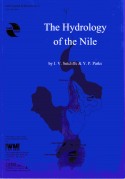 Author / Editor: J. V. Sutcliffe & Y. P. Parks Price: £15.00 This book presents an account of the hydrology of the whole Nile basin, dealing with each tributary in turn but drawing attention to links between reaches. The Nile is shown to be a set of very different tributaries which came together by geological accident. Nevertheless, evidence from one part of the basin often throws light on a different area. Recent changes are discussed, in particular the dramatic change of regime of Lake Victoria and other lakes which occurred after 1961. The relationship between hydrology and vegetation affects the important wetlands of the White Nile basin, and discussion of this relationship includes the effect of increased lake outflows. The authors draw on the extensive records collected throughout the basin to paint a detailed hydrological picture of the regime of the Nile. The book is illustrated by over 100 diagrams and photographs, and its scope is indicated by the list of contents overleaf. J. V. Sutcliffe has worked on all the major Nile tributaries over a period of 50 years and has been the author of many papers and reports on the different hydrological problems. Y. P. Parks has worked on hydrological models of the Sudd and on water resources problems of several Nile tributaries Contents for The Hydrology of the Nile
| |||||||||||||||||||||||||||||||||||||||||||||||||||||||||||||||||||||||||||||||||||||||||||||
The Use of Suspended Sediment and Associated Trace Elements in Water Quality Studies Author / Editor: Arthur J. Horowitz Price: £14.50 Suspended sediment plays a key role in the biological and geochemical cycling of trace elements in aquatic systems. As such, suspended sediment can be and is used in a variety of environmental and water quality studies. Anyone attempting to design a study involving the collection, processing and subsequent analysis of suspended sediment must develop a clear understanding of the problems associated with using this sample medium. Of particular concern are the short- and long-term spatial and temporal variations in the distribution and concentration of suspended sediment and associated trace elements that commonly occur in fluvial systems. Since 1987, the U.S. Geological Survey’s Office of Water Quality has sponsored a number of studies designed specifically to address many of the problems associated with using suspended sediment in water quality programmes. The results of these studies are summarized in this IAHS Special Publication. Contents for The Use of Suspended Sediment and Associated Trace Elements in Water Quality Studies
| Coupling Large-Scale Hydrological and Atmospheric Models Author / Editor: G. A. Schultz, M. Hornbogen, P. Viterbo & J. Noilhan Price: £17.00 Coupling Large-Scale Hydrological and Atmospheric Models Contents for Coupling Large-Scale Hydrological and Atmospheric Models
| |||||||||||||||||||||||||||||||||||||||||||||||||||||||||||||||||||||||||||||||||||||||||||||
A Methodology for the Assessment of Surface Resistance and Soil Water Storage Variability at Mesoscale Based on Remote Sensing Measurements: A Case Study with HAPEX-EFEDA Data Author / Editor: W. G. M. Bastiaanssen, D. H. Hoekman & R. A. Roebeling Price: £13.00 A Methodology for the Assessment of Surface Resistance and Soil Water Storage Variability at Mesoscale Based on Remote Sensing Measurements: A Case Study with HAPEX-EFEDA Data Contents for A Methodology for the Assessment of Surface Resistance and Soil Water Storage Variability at Mesoscale Based on Remote Sensing Measurements: A Case Study with HAPEX-EFEDA Data
| Hydrological Phenomena in Geosphere - Biosphere Interactions Outlooks to Past, Present and Future Author / Editor: Mälin Falkenmark Price: £15.00 Hydrological Phenomena in Geosphere - Biosphere Interactions Outlooks to Past, Present and Future |